Sense's Reminiscences
by Sense de Jong
Its sad demise
- Geurt
- Tante Betje (by Sense)
- Tante Betje (by Truus)
- Miss Roozendaal
- Concert in Winschoten
- A baptism remembered
- My birdhouse
- War veterans
- Henk Smit - bass/baritone
- Stefan
- In memory of Herman - I
- In memory of Herman -II
- Remembering AK
- Our love for music
- Herman - Promoter of Christian Causes
- A Salem evening with Herman de Jong
- From Elsinore to Monschau
- A Danish Treat
- Glimpses of Thuringia and Saxony
- Domie and Hansie
- La Manche, Newfoundland
- Bermuda - Isle in the Sun
- 1932 and 1934
- 1940 - 1945
- Winschoten, Grace on the Venne
- 1948
- Johann Sebastian Bach
- From Generation to Generation
- Seven children and a harmonium
- K.P. - A Man of Enterprise
- Cuba and the tragedy of the MS St Louis
- It all began in Norwich, Ontario
Another site by Sense de Jong:
~ Hinne de Jong ~
A Chronicle
Sites by Henry de Jong:
~ Herman de Jong ~
Memorial
~ Newmaker Notes~
Writings, Pictures, Collections
~ AACS/ICS Niagara Conferences~
1970 - 1991
Situated between Tors Cove and Cape Broyle, within the Irish Loop on Newfoundland's Avalon Peninsula, you will find the La Manche Provincial Park. Nearby, on the Atlantic Coast, are the remains of a legendary small fishing port called La Manche.
Prior to being settled in the late 19th century, La Manche served as a seasonal fishing ground for fishermen from Newfoundland, England, and France. Explorers long realized that the waters around Newfoundland had the best cod fishing in the North Atlantic. As a result, the coastline became dotted with little communities. The main port, St. John's, the capital, had only limited capacity, So, in time, some 300 fishing villages, or outports, were established in little coves and inlets.
In a June, 1956, article in St. John's Telegram, La Manche was referred to as "the loveliest little settlement in the entire province, set in a small cove between towering mountains, with houses that blend perfectly with the natural features of the landscape."
La Manche is a French word for "sleeve," and perhaps the French fishermen called it that, probably, as someone wrote, "because of its harbor's seclusion between the high cliffs."
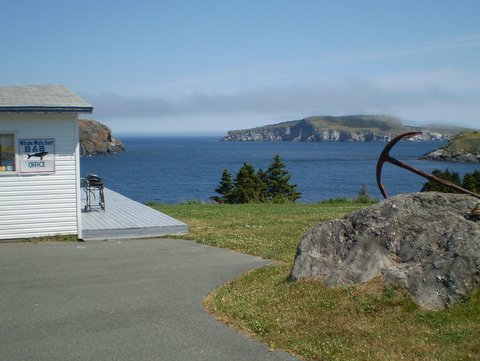
Our B&B at the Atlantic Ocean
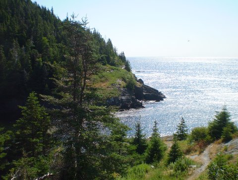
Part of the Witless Bay Ecological Reserve, as viewed from our B&B.
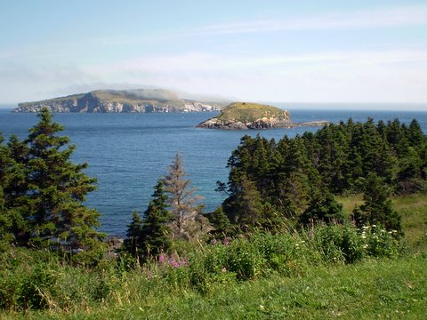
During July 2012, Corrie (my wife) and I had the privilege to stay a few days in a Bed & Breakfast at St. Michael's close to Tors Cove. Around the breakfast table we learned much about the history of nearby places, such as the Ferryland Colony of Avalon and the Witless Bay Ecological Reserve, the latter a bird sanctuary island visible in the Atlantic from our B&B. We were also strongly urged to take the time to make a trek through the woods to find the remains of the former fishing outport of La Manche.
Why remains?, we asked. And then we heard the amazing story of how and when most of La Manche had been erased from the face of the earth. It happened during a winter storm in 1966.
A once flourishing fishing village now gone
Ten years earlier, the 1956 Telegram article described La Manche as being "set in a coin of the cliff. It has a pocket-sized harbor. It has fishing stages perched on stilts. It also has houses perched on stilts. It has a beautiful river ending in a white-plumed waterfall, tumbling into tidewater. It has a wooden catwalk, instead of a main street. ...From the hills on either side, you look down on La Manche, like a toy settlement or a model laid out on a table. There is a pool in the river, just before it enters the canyon for the falls. It is just above the settlement, with grassland on one side and sheer cliffs on the other."
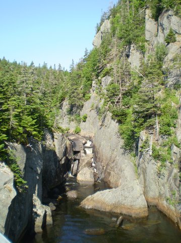
The canyon of La Manche.
Part of the grasslands located above the village.
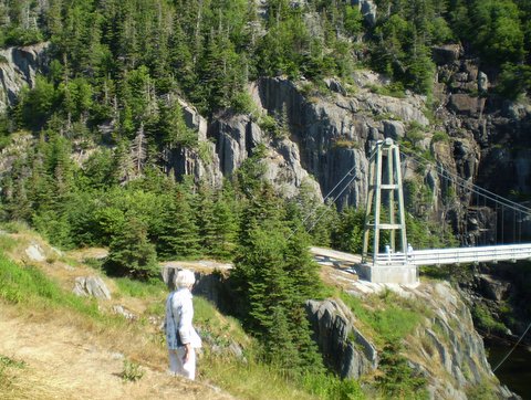
The present suspension bridge across the deep gorge.
There is a world-renowned hiking trail, known as the East Coast Trail, linking Newfoundland's Avalon Peninsula from Cape St. Frances in the north to Cape Race in the south, a 270- kilometer distance. It runs smack through the La Manche site right across the suspension bridge spanning the canyon.
The Telegram writer was obviously enraptured by the beautiful scene before his eyes. He wrote: "The catwalk is built of necessity along a stretch of cliff where, without the expenditure of tons of dynamite and months of effort, no road could find a foothold. It forms the main road from the suspension bridge to the point on the north side of the harbor. Along this point and on the other side, stages and stores climb the slopes on crazy stilts. ...Sea trout run up the estuary and splash under the falls. Flatfish lie along the bottom. Within a stone's throw of the headland the codfish come in early summer, while salmon make their way along shore in spring, and mackerel come in shoals in the fall. The gulls wheel overhead, and the surf from the open Atlantic roars along the rocks."
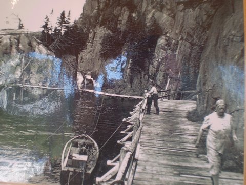
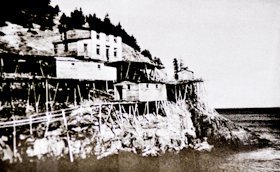
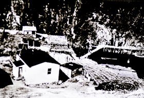
What La Manche looked like in the early 20th century.
However, the 1956 newspaper article also revealed that, like in many other settlements on the Newfoundland coast, the population of La Manche appeared to be shrinking rather rapidly. It stated that half the houses were vacant, as families abandoned the fishery moving away to work for "cash wages." In fact, between 1954 and 1975 many Newfoundland fishing outports were abandoned as part of a Canadian government program known as the Resettlement.
(Note: According to the Wikipedia website "in the 1960s, some two billion pounds of cod were harvested annually from the Grand Banks off Newfoundland, the world's largest source of fish. Then disaster hit. The northern cod practically vanished. In 1992, the cod fishery was shut down by the Canadian government; cod fishing as a away of life came to an end for 19,000 workers after a 500-year history as a main industry.")
Lamented the Telegram writer: "It is a pity, one thinks, that such a beautiful spot (as La Manche) must be abandoned by so many of its people, and left to the enjoyment of the casual visitor, who stops for an hour or so, only to pass on to other places of much less charm and character."
Little did the author of that article realize that, ten years later, on January 28, 1966, a devastating storm in the Atlantic would destroy nearly all of La Manche. The fishing premises, much equipment, the wharfs, the boats, the suspension bridge and nearly everything else were swept to sea as a result of successive tidal waves. As far as I know, no lives were lost; the people went to higher ground in time. According to Martin Melvin (see below), one house, built on the level of the fishing premises, almost disappeared as well. The mighty waves shifted the house, causing so much damage that it was declared unfit for habitation. Houses higher up or on the cliff were later abandoned by the residents. All that remains today of the former town site are foundations upon which the houses stood and cables which supported the bridge.
The ocean entrance to La Manche's cove today.
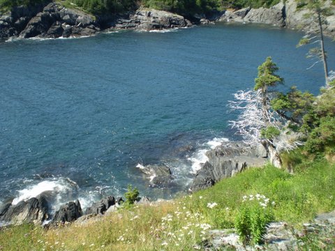
The once bustling harbor, now empty.
The Melvin family connection
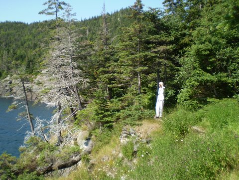
On July 26, 2012, on a bright, sunny day, Corrie and I drove along Route 10 (Irish Loop) and found a small sign pointing to La Manche. Following the directions we came to a small, unoccupied, parking lot. After a considerable hike we came to a rise and a grassy area. Soon we beheld the vastness of the Atlantic ocean. We also knew we were no longer alone, because we heard voices and saw movement in the woods and along a trail which turned out to be part of the actual East Coast Trail.
We also saw the new suspension bridge which, we learned, was erected by the East Coast Trail Association in 1999 (official opening took place on June 17, 2000). Why did it take so long to replace the one destroyed in 1966? But that's another story by itself....
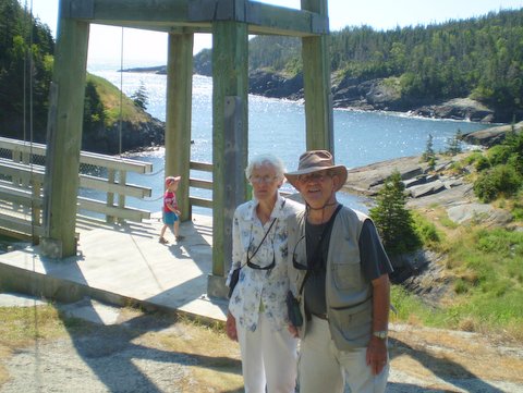
Sense and Corrie in front of the new suspension bridge. Note the totally empty harbor in the background.
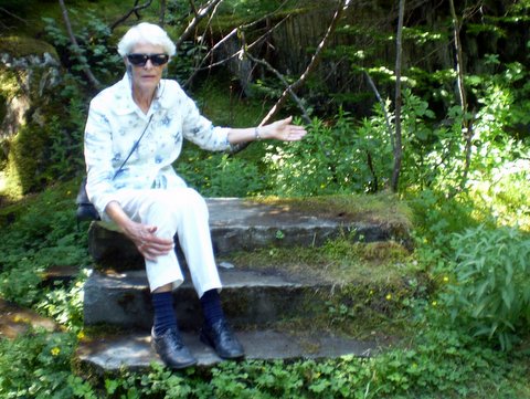
Why are these stairs here?
In silence we walked up and down the place of Martin's former village. All of a sudden we came upon the foundations of a few houses, now vanished: a concrete pad, remnants of a chimney, a series of stone steps leading to nowhere. From up high we looked down into the cove, now totally devoid of any fishing premises or stages built on stilts against the rock face. The stillness and the beauty of the site, the waterfall descending from up high into the canyon, kind of touched us. We took many pictures, as well as collected old ones, and they speak for themselves.
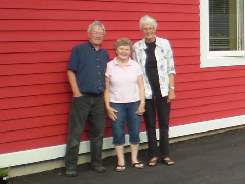
Corrie with Martin and Alison Melvin, who lived next to the B&B
Some of the old memorabilia we collected from a former La Manche resident, who lived - lo and behold - right next to our B&B. The day after our visit to La Manche, we unexpectedly ran into Martin Melvin and his wife, who warmly welcomed both of us into their cozy home. They became really excited when they heard we had trekked to the place of their former village.
We learned then that the first permanent settler of La Manche turned out to be a George Melvin who arrived circa 1840 from nearby Burnt Cove, followed shortly afterwards by other family members. Martin is a descendant of that same George Melvin and he told us he was born and raised in La Manche. The community always remained small. But it did have a small building that functioned as a school and a church, the latter served by a travelling Roman Catholic priest.
Its population rose to around 54 around the time of Confederation (1949). A majority of the residents were opposed to being resettled. However, the closure of the school and the isolation of the community prompted some to leave. By 1961 the population had fallen to 25. However, their resolve to stay gave way after the 1966 disaster.
I read on a Maritime History Archive website that the old images "convey a sense of how hard the people of La Manche must have worked to run the fishery from that difficult location." Our talks with Martin and Alison Melvin confirmed this.
Today, the most famous feature of La Manche is the new suspension bridge. It is in the heart of the former fishing village, with the East Coast Trail winding through the remaining building foundations, a beautiful falls and a secluded swimming pool. We invite the readers to go there someday, to walk the trail and see the site for yourselves!
[an error occurred while processing this directive]